Tech & Gadgets
Garmin Handheld GPS: Benefits of Reliable Navigation
The trend to declutter traditional avionics dashboards started almost a decade ago. It was when new models introduced primary flight display (PFD) and multifunction display (MFD) to replace the analog instruments that used to be there.
Avionics were designed to provide reliable information concerning performance, control and navigation through all sorts of instruments. For example, the current performance of the aircraft could be determined by checking indicators such as altimeter, airspeed, vertical speed (VSI), heading indicator and turn and slip indicator. A pilot compares this information against the navigational fix and this affects the subsequent decision-making process. Before they turn to make calculation (and conversion of all the different measuring units) though, they need to check their navigational instruments like global positioning system (GPS), the omnidirectional beacon (NDB), the instrument landing system (ILS, if applicable) and others.
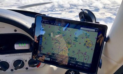
Since not all aircraft are fitted with glass cockpit (electronic screens instead of mechanical gauges and gyroscopic flight instruments) using flying applications has become a sort of a trend. Commercial airline pilots can take electronic devices in their flight bags on a regular basis and with the full blessing of their immediate authorities (i.e. employers). Although they still need to adhere to many other safety procedures having portable avionics like Garmin handheld GPS devices can be useful too.
Garmin Handheld GPS Avionics
These are called GPS devices, however, they are much more than that because they offer many other functions that are sort of an electronic flight bag essentials. One can develop a flight plan on these things. The amount of data that can be set to automatically download is staggering and involves info regarding weather, air traffic, wire strike avoidance, georeferenced taxiing diagrams, IFR en route charts, airport information, fuel prices, etc. They have sunlight-readable touchscreen displays, at least 4-hour battery life (can be charged in-flight via USB cable), PDF viewer, E6B computer, weight and balance calculator, logbook. You start to see why they serve as an electronic flight bag.
Equipped with powerful SBAS/WAAS/GLONASS receiver, they offer high-sensitivity with WAAS position accuracy. You can use them to navigate through terminal traffic before and after landing, you can use detailed ground references on topographic maps including data on terrain, obstacles and VFR sectional charts. If you don’t already know them, you can find and upload frequencies of NAV/COMM radios. And a number of apps can be integrated to provide up to date and relevant notifications aimed to aid your decision-making process.
In terms of physical dimensions, we are talking about a gadget that is not longer than 20cm and is as thin as 2 cm. However, as impressive as all these functions may seem, please don’t rest solely on portable avionics. These mini-computers have come a long way, however, do go through all steps of flight training on traditional equipment especially if you are just starting to roam the sky. They can greatly assist but aren’t able to completely replace all other avionics instruments. Not yet, to be more precise.
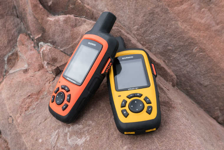
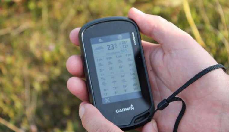
Garmin inReach
Although typically used by outdoor enthusiasts and mariners, Garmin inReach has many in-flight applications that can be used to stay in touch while in the sky. Not only will it allow you a two-way satellite communication (text messaging) via low orbit satellite network, it can also offer weather forecast service.
In an emergency, you can use the Garmin inReach for location sharing, navigation and critical SOS functions. This technology is similar to the one used to track dogs, so if you prepare your gear timely, rescue services will be aware of your location even if you are unconscious or incapacitated in any other way. Having it in your emergency grab bag along with other essential survival items can literally save your life.
To be able to really count on it, this GPS unit is made from durable materials. This makes it highly functional in adverse conditions (IPX7 rated) and its battery life is adjusted for a prolonged emergency operation. Hopefully, you won’t need much time because the emergency response can be remarkably fast.
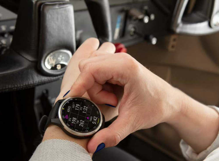
Aviator GPS Watch
This is the wrist-worn version of your GPS flight navigation gadget. It looks like a plain watch, however, it’s much more than that. There are many aviation functions that are simply not available in other smartwatches. These include NEXRAD weather, automatic flight logging, dynamic colour mapping, all sorts of alerts, airport data and integration with some of your proper avionics. It has a Pulse Ox sensor that can provide you with information on blood oxygen saturation. You can push it further in terms of physiological metrics for wrist-based heart rate tracking, fitness tracking and other similar functions you would expect from a sports watch.
You can put up to 500 songs on it to isolate yourself from the surrounding (and no phone in between needed either). And when you want to return to civilization, these GPS watches provide contactless payment. We are talking proper and premium GPS aviator watches that make global flight navigation capability available on your wrist. These suit pilots and flying enthusiasts alike.